Outlying area developments
Rural development is a process of redesigning the outdoor area of municipalities. Until about 15 years ago, it was mainly farmers who determined the appearance of the countryside. Today, it involves agricultural entrepreneurs, recreationists, nature conservationists and residents. The interests of these people can sometimes clash. The municipality guides this process so that all functions of the outlying area are done justice. Here you can read how you can contribute to developments for the outlying area, what has happened so far and what the new plans are.
Ervenplus
Do you live in the countryside and would you like to participate in more biodiversity in your yard? Then you can apply for the ErvenPlus3.0 project in Geldrop-Mierlo. This project ensures that animal species living on farmyards, such as the swallow, sparrow, owl and bat, get an improved living environment. This is done with various measures, such as planting, hanging nesting boxes and sowing special seed mixtures. In this way, you can help increase biodiversity in the countryside.
Landscape Incentive Scheme (STILA).
The Landscape Incentive Scheme is a scheme of the province, municipalities and water boards in North Brabant to encourage landscape management by private landowners. These landowners can apply for compensation for the construction and management of landscape, and water elements, footpaths on farmland and edges. This also includes compensation for the contribution of agricultural land in the construction of new landscape elements. The municipality of Geldrop-Mierlo also participates.
Transition Rural Area
The municipality of Geldrop-Mierlo works together with the other municipalities in the Eindhoven Metropolitan Region (MRE) to anticipate developments in the rural area. To this end, the council adopted the target scenario rural area in 2020, just like the other municipalities in the MRE region.
The content of this target image was also included in the creation of the surrounding vision Geldrop-Mierlo.
Dommel valley out of focus
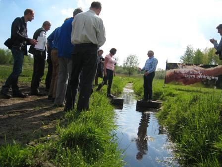
Geldrop-Mierlo works together with the municipalities of Eindhoven, Nuenen and Son en Breugel, water board De Dommel, Staatsbosbeheer and the Brabants Landschap on the nature task for the Dommel valley between Geldrop-Mierlo and Son en Breugel. A letter of intent was signed for this in 2018. The Dommel Valley is part of the Nature Network Brabant, but many lands are not yet set up as nature. As a result, nature sometimes struggles. Through land acquisition and land exchange, the participating parties want to add additional nature and also provide more space for recreation and tourism. More information can be found in this flyer and on the Brabants Landschap website.
Cotton Pad

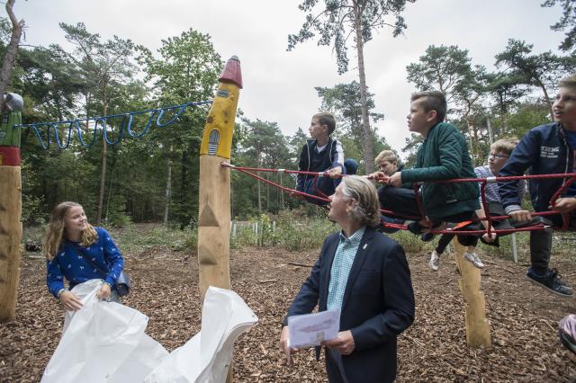
In September 2018, the Katoenpad on the Molenheide opened. This is the old walking route between Mierlo and Geldrop. Over this path the Mierlo home weavers walked to the factories in Geldrop to deliver their wool (products). It is unclear why this path was called 'Katoenpad'.
The path served as inspiration for Marianne Canters to write a book, The Secret of the Lost Cotton Path. On the experience section of the Cotton Path, elements from the book and the weaver's past recur. Play facilities have also been installed. For more information, visit the Cotton Path website at .
Area process Gijzenrooi
Gijzenrooi is a valuable small-scale agricultural cultural landscape around the Gijzenrooise Zegge. The Brabants Landschap and the municipality of Geldrop-Mierlo are the largest landowners in the area. We want to strengthen this special landscape and make it more accessible. We want to do this together with local residents, involved area partners and inhabitants.
For this purpose an area process was started in early 2022, in which we have had several discussions with both the area partners (such as Waterschap de Dommel, Province and Municipality of Eindhoven) and with the residents as environment (October 2022 and December 2023). You can find more information on the page 'area process Gijzenrooi'.
Meanwhile, the area process has resulted in a Gijzenrooi Master Plan adopted by the City Council (December 2024). This master plan provides clear frameworks for the next steps. Such as the search for a market party to manage the Gijzenrooi area for both the municipality and Brabant Landscape. Also how the procedure for starting up the meeting yard should be approached and how the Gijzenrooi area will become wetter in the coming years. Together we will work to strengthen and improve the valuable small-scale agricultural cultural landscape Gijzenrooi. The Gijzenrooi Master Plan can also be found on the Gijzenrooi area process page.
Sang and Goorkens

The wetland pearl Sang and Goorkens is a special nature area with flowery grasslands, alder thickets, peat pits in an ancient coulisse landscape. In recent years the area has become increasingly accessible and the municipality, in cooperation with the State Forestry Administration (manager of the area), Water Board and Aa (responsible for water management in the area), has opened up several hiking trails.
In 2017, the first walking route in Sang and Goorkens was opened: 'Rondje 't Sang'. The route is 2.4 kilometers long. For more information, visit the website of VVV Geldrop-Mierlo.
Then in 2018, two more new hiking trails were included in the Brabant hiking trail network south of Mierlo. Hikers can now walk along a water board inspection path along the Kasteelseloop. A hiking bridge provides a connection to the existing hiking trails in Sang and Goorkens.
Further on, it is possible to walk from the Voortje along a new footpath along the forest edge toward Broekkant/Winkelstraat.
There is also a variety of information about the area on the Forestry Commission site. See: https://www.staatsbosbeheer.nl/uit-in-de-natuur/locaties/sang-en-goorkens
Disturbed peace?
Not only do the new trails attract hikers, but cyclists and even moped riders use the new trails through the area. As a result, recreational pressure has increased considerably in recent years, putting pressure on the natural values in the area. This is also because hikers do not keep their dogs on a leash, but often let them run loose with negative consequences for young deer, birds and vulnerable orchids.
New welcome signs were installed in August 2022 so that all visitors know that the trails are for walking only and that dogs must be kept on a leash.
At the request of the council, plans are currently being developed to install other features in addition to the welcome signs to keep cyclists out of the area.
Footpath Bekelaar-'t Sang
Together with the owners of Hof van Huijbers in Mierlo, the Bekelaar-'t Sang footpath has been laid out and made accessible. From Hof van Huijbers this footpath first runs across farmland to end up at the Goorloop. You can also continue walking via the other footpaths in Sang and Goorkens.
The path is open to everyone, but it is definitely intended for guests of Hof van Huijbers. We recommend that you put on appropriate shoes or boots, as some of the path is quite wet.
The lesser kingfisher butterfly

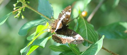
The lesser kingfisher butterfly is an endangered butterfly that still occurs in few areas. One such area is the Sang and Goorkens nature reserve. To strengthen the population, the current habitat is being connected to the Dommel valley, which can also be a suitable habitat for this butterfly. Staatsbosbeheer started this in 2014. Several measures are being taken to better connect the two areas. There is a bicycle route that has been created along the butterfly's habitat, the Small Kingfisher Butterfly Route. You can find this route on the Little Kingfisher Butterfly Cycle Route page.
Castle of Mierlo
The former castle site in Mierlo has been designated as a municipal archaeological monument. The remains of the castle of 'Mierlo' from the Late Middle Ages-New Age (1000-1950) lie on the edge of the built-up area of Mierlo. The grounds on the Kasteelweg, Trimpert and Heer de Heuschweg are now used as pasture land. Two information points with viewing windows bring this piece of history back into the landscape in a special way.
Archaeological research
With new archaeological research, the municipality wanted to find out more about the exact location of the castle and the state of the archaeological remains in the soil. The research was conducted by the Kempen- and Peelland Archaeological Society with the cooperation of the Myerle local history society. You can read the results of the research in the archaeological report:
3D visualization
Fransenaudiovisuals, with the support of residents of Mierlo and Omgevingsdienst Zuidoost-Brabant, created a 3D visualization of the former castle. This can be viewed online in the form of five videos on the website of Verweven. These videos can be used for all kinds of different purposes, for education, recreation and tourism, cultural-historical events and the like.
Own initiatives
Entrepreneurs and inhabitants can propose ideas to improve the liveability, strengthen the economy or develop nature in the outskirts of Geldrop-Mierlo. The municipality can see how this can be supported. In the (draft) environmental vision, which will most likely be adopted in early 2023, we will also zoom in on the rural area in our municipality and you can take note of our current ambitions for the outlying area.
Agricultural sector
The municipality supports a number of initiatives from the agricultural sector to make their businesses more sustainable and innovative. We pay attention to animal welfare, environmental quality and proper incorporation into the landscape.
Biodiversity
Biodiversity is the variety of animals, plants and microorganisms. The municipality considers this important and wants to make it visible. Many different animal and plant species make for a robust nature that can withstand a beating. We sow fallow land with butterfly mixtures. We also provide traffic circles with richer planting. The municipality also uses a code of conduct for flora and fauna, so that we also pay attention to biodiversity in the ordinary maintenance of green spaces.
More information can be found on the Biodiversity page.
Animals grazing for more biodiversity
In Geldrop-Mierlo, animals graze for higher biodiversity in several areas, including De Meer-Coeveringse Heide and Molenven-Lisven. The animals provide more structure and variation than we can achieve with mowing alone. Grazing creates a varied terrain in which more and more animals find their habitat. The grazing period is from March to November.
The Akert
The management area 'De Akert' is located in the valley of the Kleine Dommel. In this area we strive for a small-scale cultural landscape with wooded banks, canals and species-rich grasslands.
The Lake-Coevering Heath
This is a beautiful area that consists of heathland, forest and some fens. To maintain the area, it must be actively managed. To get more structure and variation in the heathland, Scottish Highlanders graze here. This is done because a lot of grass grows between the heather. There is a lot of recreation here and sheep react very badly to (stray) dogs. Scottish Highlanders are less bothered by this.
Millven-Lisven
The Lisven is linked to the Millven with a wetland zone. It is an area with mainly dry and moist heathland. In certain periods, sheep are used here to maintain the heathland. With their grazing pattern, the sheep provide a gradual transition in vegetation (overgrowth). During the flowering period of the herbaceous plants there is no grazing. This gives these plants time to flower and form seeds, creating a more species-rich heathland.
Area-based approach Strabrechtse heide
Geldrop-Mierlo is also working with numerous partners, such as the municipality of Someren, Heeze-Leende, water boards Aa en Maas and de Dommel, ZLTO, Staatsbosbeheer, Brabants Landschap to tackle a number of tasks on and around the Strabrechtse heath. A lot of hard work will go into this in 2023.
The Strabrechtse Heide consists largely of sloping top sand landscape, with next to it a part of shifting sand landscape. The area is characterized by an alternation of dry areas with heathland (partly on former drifting sand), small drifting sands and low areas with wet heathland and fens. In the east of the area is the Beuven, the largest fens in our country. Here one of the first fens restoration projects was carried out, leading to the return of rare species. A number of fens are partly fed by local seepage. The area's surrounding forests consist mainly of Scots pines. On the northwest side of the area lies the stream valley of the Kleine Dommel, with alluvial forests, willow thickets, marsh scrub and wet scrublands.
The tasks in and around the Strabrechtse Heide
- Accelerate and intensify nature restoration Natura2000 area;
- Completing NatureNetwork Brabant;
- Restoration of fens;
- Optimize water resources and eliminate desiccation;
- Improve water quality and achieve Water Framework Directive goals;
- In the shell unite different functions such as water, nature, agriculture, and recreation;
Perspective for continuing farmers in the transition zones to continue farming in balance with the environment.
More information can be found on the Greenblue Area Approach website.
Contact information
Do you have an idea or plan about developments in the outlying area? Please contact Robijn Andringa (policy officer green and nature) or Stefan Olschewsky (jurist space / planologist rural area. This can be done via telephone number 040 289 38 93 or e-mail address gemeente@geldrop-mierlo.nl.
For example, it could be a secondary activity of your business, conversion to another form of business, revitalization of a building or a plan for land exchange. The municipality will go through the steps with you to develop your idea. Ideas for creating a pond or a wooded area are also welcome. Or if you want to exchange views on ongoing developments in the outlying area, you can approach us.